|
数据搜索系统,热门电子元器件搜索 |
|
|
数据搜索系统,热门电子元器件搜索 |
|
MDEV-GPS-R4 数据表(PDF) 7 Page - Linx Technologies |
|
|
|||||||||||||||||||||||||||||
MDEV-GPS-R4 数据表(HTML) 7 Page - Linx Technologies |
|
|
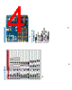
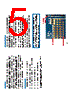
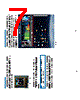
7 / 9 page  – – – – 8 9 The Display Section The Master Development System features an OLED screen that displays the navigation information from the receiver module. This allows the development board to act as a stand-alone evaluation system without the need for any additional software. The display is driven by an on-board microcontroller located under the display. Data from the receiver module is connected directly to this microcontroller. The microcontroller receives data at the receiver’s default 9,600bps. The display and microcontroller pull about 100mA when fully powered, so a power switch is supplied to deactivate the display area when not in use, saving battery life. To protect the display and extend its life, be sure to turn the display section off before turning off the main power to the board. Figure 7: The Development Board Display Section Note: If the receiver’s baud rate is changed, it will not be able to communicate with the microcontroller. Master Development Software The development system is supplied with Windows-based software that communicates with the development board through the USB module. This software displays the information from the receiver module in the different NMEA formats and the satellite information, signal strength, and positions are displayed graphically. If the PC is connected to the internet, the software plots the current location on Google Maps. Full details are in the software’s User’s Guide. Figure 8: Master Development Software |
|
|
链接网址 |
| ALLDATASHEET是否为您带来帮助? [ DONATE ] |
关于 Alldatasheet | 广告服务 | 联系我们 | 隐私政策 | 数据表链接 | 链接交换 | 制造商名单 All Rights Reserved©Alldatasheet.com |
| Russian : Alldatasheetru.com | Korean : Alldatasheet.co.kr | Spanish : Alldatasheet.es | French : Alldatasheet.fr | Italian : Alldatasheetit.com Portuguese : Alldatasheetpt.com | Polish : Alldatasheet.pl | Vietnamese : Alldatasheet.vn Indian : Alldatasheet.in | Mexican : Alldatasheet.com.mx | British : Alldatasheet.co.uk | New Zealand : Alldatasheet.co.nz |
|
Family Site : ic2ic.com |
icmetro.com |
 Chinese ▼
 English
 Chinese
 German
 Japanese
 Russian
 Korean
 Spanish
 French
 Italian
 Portuguese
 Polish
 Vietnamese
 Indian
 Mexican
 British
 New Zealand